
Lake Bogoria irrigation project hits 95% as govt works to stop Baringo, Bogoria merging
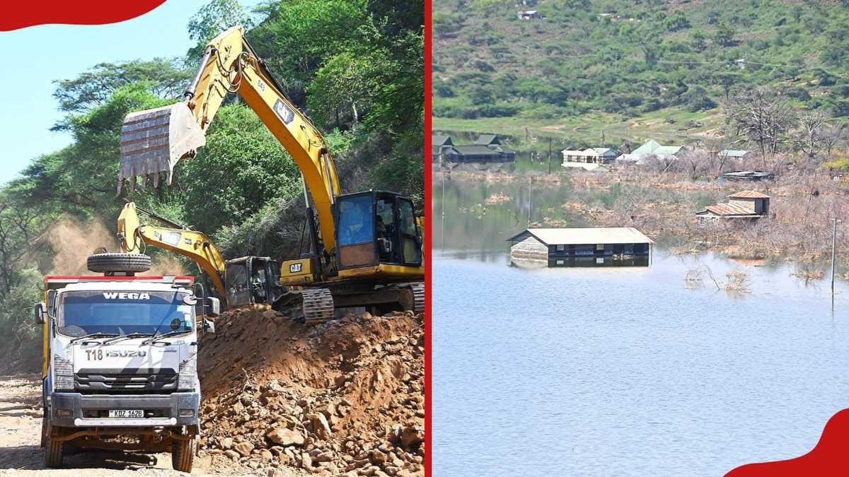
The government says the first phase of the Lake Bogoria Irrigation Project is about 95% complete, as it steps up efforts to stop rising waters from merging Lakes Baringo and Bogoria and to protect homes and farms in the area.
Irrigation Secretary Michael Thuita led a team of technical experts on an inspection of the works, which form part of a wider government plan to manage the swelling lakes, according to Tuko.
Rivers redirected
Work under phase one has focused on river training and riverbank stabilisation along the Waseges and Loboi rivers. The stabilisation works on the two rivers have been finished, the report says.
Interventions on both rivers have changed their flow paths, meaning they no longer drain into Lake Bogoria. Reducing the volume of water entering the lake is central to the plan to keep it from rising further.
Bankside stabilisation structures are also close to completion. Together with the river training works, they are intended to prevent water from Lake Bogoria from spilling over into Lake Baringo.
Such a merger would threaten the ecological integrity of both lakes. The two Rift Valley lakes in Baringo County have distinct characters, with Lake Baringo a freshwater lake and Lake Bogoria known for its saline, alkaline waters.
Residents report relief
People living near the lakes say they have seen clear improvements since the works began, Tuko reported.
Before the interventions, some families had watched as rising water levels swallowed their homes and farmland, leaving them counting losses.
Irrigation to expand sixfold
With phase one nearly complete, attention is shifting to phase two, which centres on expanding irrigation in the area.
The next stage aims to increase the land under irrigation from the current 1,000 acres to about 6,000 acres. Coverage will be extended to the Loboi and Sandai communities.
The expansion is expected to:
- Raise agricultural output in the region
- Strengthen food security
- Improve livelihoods for local residents
Lake Baringo depth mapped
In a separate development, the State Department has completed a bathymetric survey of Lake Baringo.
The survey provides baseline data on the depth and water levels of the lake. The findings will guide decisions on whether some of the water needs to be evacuated as part of longer-term water management.
The government says the project is designed to tackle both the immediate risk of flooding and long-term development goals in the region.
Officials have framed the rising lake levels not only as a threat but also as an opportunity to unlock greater agricultural and economic potential for communities around the two lakes.
Lakes across Kenya's Rift Valley have experienced rising water levels in recent years, displacing families and submerging public facilities, prompting calls for lasting solutions.
No timeline for the start or completion of phase two was given in the report.
This story was prepared by the Hamasta Newsdesk with AI assistance, based on reporting by Tuko. Read the original report. Photo: Tuko.

Tell your story on screen.
Commercials, documentaries, interviews and social video, from script to final cut.





More in Environment
See all
William and Kate name Bhutan among five Earthshot Prize winners in Mumbai
Nairobi's 'Green City in the Sun' title at risk as construction boom fells trees

COP31 draft deal exposes rifts as fight over IPCC report timing deepens
Green Belt Movement Rejects Plan for Crematorium at Nairobi City Park
Kenya Met: Rain expected in 36 counties as north braces for heat above 35°C
Global Community Remarks
0